 |
 |
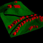
Photo: A view from ArcView 3D analyst |
||||||||||||
| Home > Academic > GIS | ||||||||||||||
|
What is
GIS?
A GIS (Geographic Information Systems or Geographic Information Science) is a computer system capable of assembling, storing, manipulating, and displaying geographically referenced information, i.e. data identified according to their locations. This technology can be used for scientific investigations, resource management, and development planning. For example, a GIS might allow emergency planners to easily calculate emergency response times in the event of a natural disaster, or a GIS might be used to find wetlands that need protection from pollution. The way maps and other data have been stored or filed as layers of information in a GIS makes it possible to perform complex analyses. Source: USGS Softwares ArcGIS (ESRI) IDRISI (Clark Labs) MapInfo TransCAD (Caliper) GIS courses taken during my undergraduate years 183-201 Geographic Information Systems I 183-306 Geographic Information Systems II 183-307 Socioeconomic Applications of GIS 183-308 Principles of Remote Sensing 409-505 GIS in Planning For the 409-505B GIS in Planning course project, I have done a small project assessing the usage of the commuter train stations in West Island. You can view my report here. Links Environmental Systems Research Institute (ESRI) Caliper Corporation MapInfo Clark Labs Walter Hitschfeld Geographic Information Centre |
"The application of GIS is only limited by the imagination of those who use it." Jack Dangermond, President, ESRI.
|
||||||||||||